
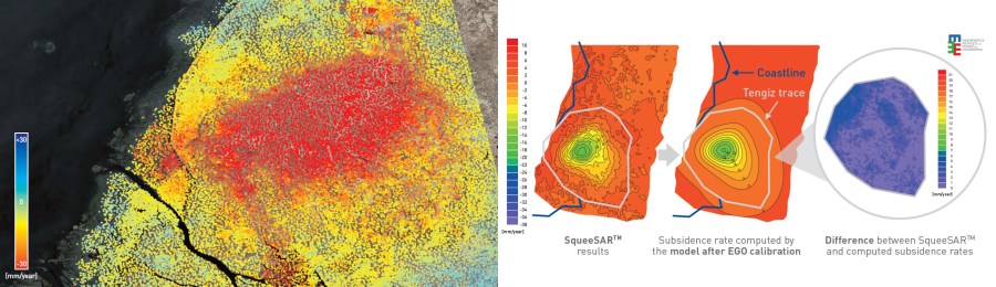
Geomechanical Model Calibration: Surface displacement data can be used to calibrate geomechanical models to determine pressure and volume changes in the subsurface. Red measurement points indicate movement away from the satellite (typically subsidence), green indicates stability and blue is towards the satellite (typically uplift) [Img src TRE-Altamira]
Geomechanical Model Calibration: Surface displacement data can be used to calibrate geomechanical models to determine pressure and volume changes in the subsurface. Red measurement points indicate movement away from the satellite (typically subsidence), green indicates stability and blue is towards the satellite (typically uplift) [Img src TRE-Altamira]
